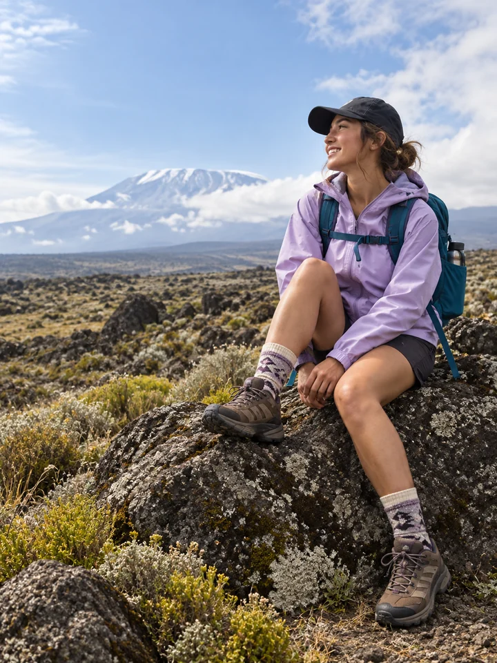
Choose the picture you want to make
To put Strava stats on a photo, start with Strava’s own sharing tools. To place a route outline and a separate block of data anywhere on your photograph, you can manually bring a route screenshot or GPX file into Wildfolio on iPhone.
The two options solve slightly different problems. A quick share is useful when the standard layout is enough. A separate editor gives you control over the route’s position, the text and how much of the photo they cover.
Use Strava’s built-in sharing for a quick result
Open a GPS-recorded activity in Strava, tap the share icon, then choose Share To. If the activity has photos attached, you can choose a photo or map; Strava adds relevant stats. Select the app you want to share through. Stationary, indoor and manually entered activities do not support a map or image with stats in this flow. See Strava’s activity-sharing instructions.
Prepare your photo and activity
For an editable composition in Wildfolio, you need an iPhone with iOS 17 or later, a photo you can use, and a route source. Pick one of these:
- A route screenshot: keep the complete route visible and avoid covering it with app controls. If the metrics are on another screen, use a data screenshot from the same activity.
- A GPX track: useful when you want to import recorded coordinates instead of extracting a line from a screenshot.
- A completed Wildfolio hike: open the saved outing and choose Make a trail photo.
Getting your own GPX from Strava
On the Strava website, open one of your own GPS activity pages. In the ellipsis menu, choose Export GPX. Transfer the downloaded file to your iPhone’s Files app. Strava documents export as a website feature; an activity without GPS data can produce an empty or unusable GPX. See Strava’s export guide.
In Wildfolio, GPX is a source for creating a route photo. It is not a request to navigate the route or edit the original activity.
Make a route photo in Wildfolio
- Open the editor. From Hiking records, open Make a trail photo, then Start creating. If you are using a completed Wildfolio hike, open its details and make the photo there.
- Add the source material. Select your photo and route screenshot, or choose Or import a GPX file. Add a matching data screenshot if needed.
- Create the first layout. Tap Create photo. Review the visible route against the source. Screenshot recognition can miss details; a line cut off in the original screenshot cannot be recovered reliably.
- Check the numbers. Open Review data. Confirm the title, distance, units, time meaning and any ascent figure. Leave an unknown value blank.
- Arrange the layers. Select Route or Activity data, drag it to a new position, then adjust size and opacity. Choose a text color that stays readable.
- Keep and share it. Use Save edits when available to keep the editable composition, and Export for a picture in Photos or another app through the system share sheet.
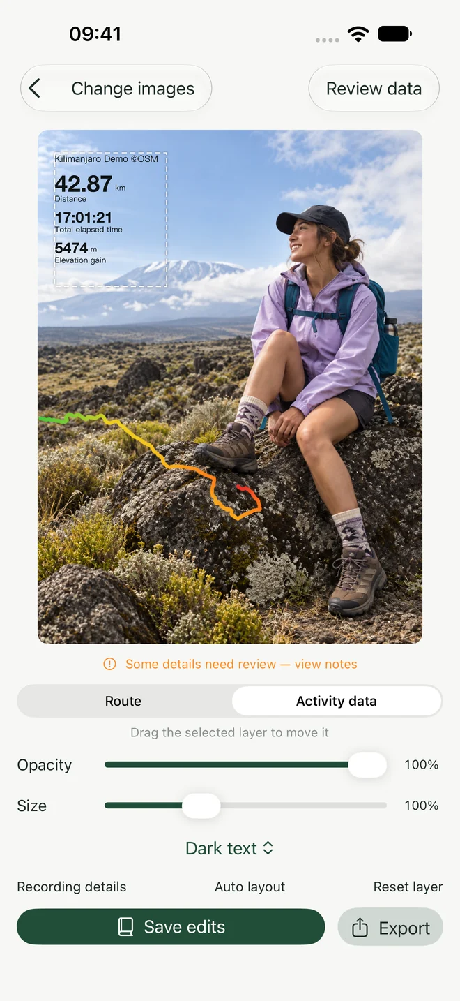
Check the meaning of time. Moving time and total elapsed time are different. Wildfolio’s own recorded total time includes pauses. Use the label that matches the number in your source; do not silently swap one for the other.
Three small choices that improve the result
Give the subject some room
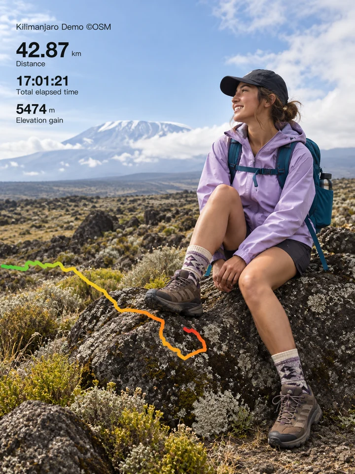
Place the route in the open part of the image. In the example above, the line sits below the hiker instead of crossing the face. Try the lower third or a quiet corner before making the route larger.
Keep data against a calm background
Sky, water and open ground are often easier to read over than leaves or rocks. Use dark text against a light area, or light text against a dark area. Check the result at the size someone will see on a phone.
Use fewer, more meaningful numbers
A title, distance and clearly labeled time are usually enough to tell the story. Add elevation gain when it matters to the outing. A crowded photo is harder to read than a simple one.
Before you export
Does Wildfolio connect directly to my Strava account?
No. This guide uses manual file or screenshot import. Wildfolio is an independent app and is not affiliated with Strava.
Why does the extracted route look incomplete?
First compare it with the original screenshot. Cropping, covered sections, faint colors and map labels can affect extraction. Try a clearer complete screenshot or a GPX track. Review the output before sharing; do not fill in a missing section by guessing.
Why do the numbers differ from another app?
Check units, whether time means moving or elapsed time, and whether the figure is imported from a screenshot or calculated from a track. GPS estimates and source data can differ. Use Review data and compare with the original activity.
Will the exported image contain my private notes?
Wildfolio does not automatically add private journal notes or copy the original photo’s EXIF/GPS metadata into an export. The visible route, title and photograph can still reveal where you went, so inspect the actual image before posting it.
Want the photo to become part of a longer story? Add it to a hiking journal, alongside the details that did not fit on the picture.